Waiheke Island
✿ Concept project – Illustrated Map ✿
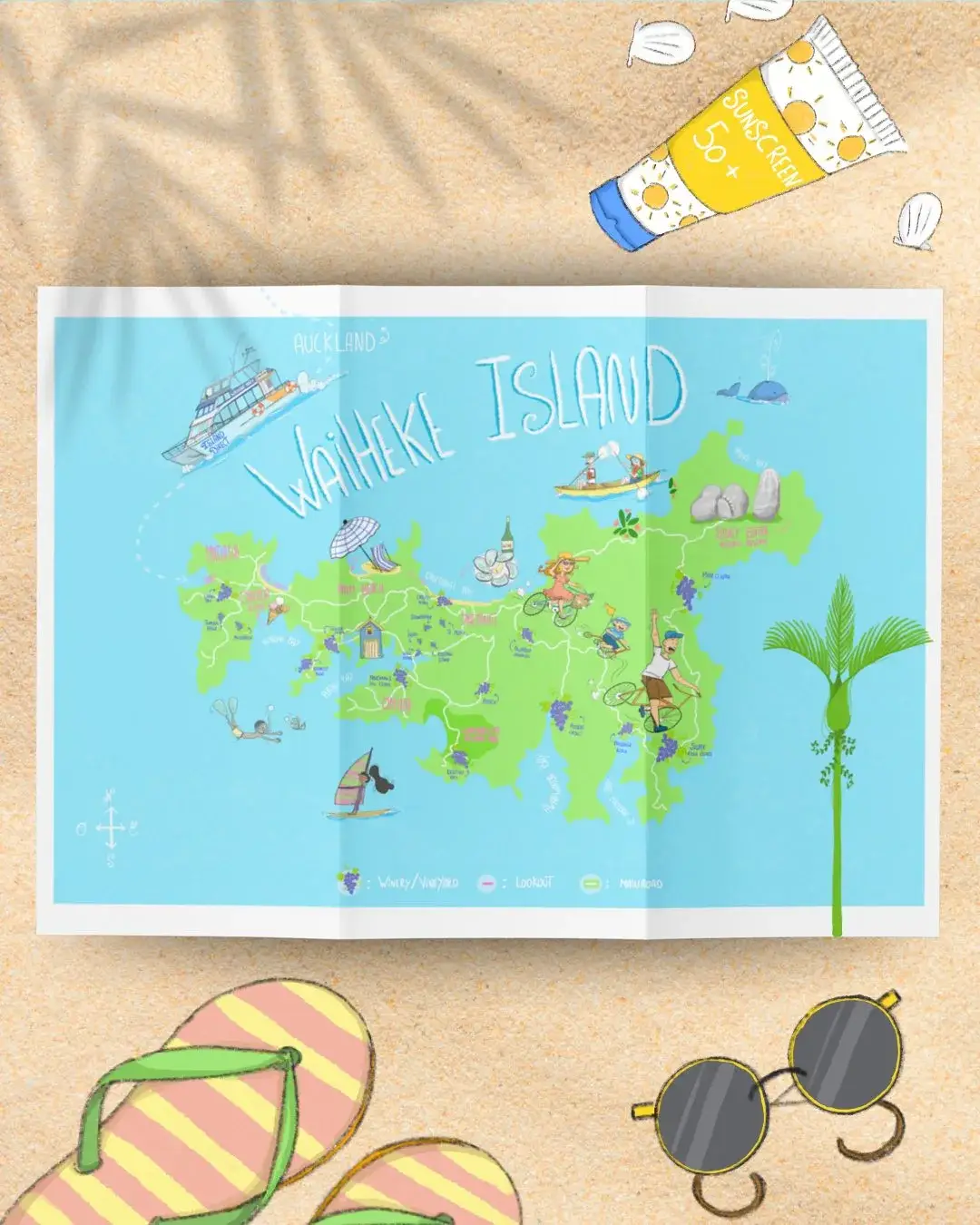
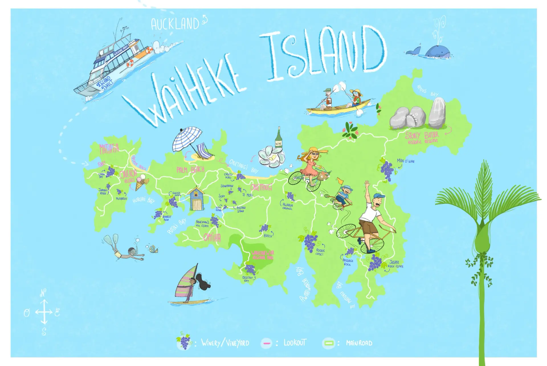
An illustrated map created to help visitors find their way around the Island to enjoy the wine testing, lookout etc..
✿ French version ✿
Après avoir passé un week-end à vélo sur Waiheke Island, j’ai eu envie de capturer ce qui rend cette île si particulière.
Pas seulement les lieux en eux-mêmes, mais surtout cette sensation de ralentir : prendre le temps d’explorer, d’admirer les points de vue, de s’arrêter sur une plage, et de partager un verre de vin en chemin.
Cette carte illustrée est un projet concept personnel, né d’une expérience vécue plutôt que d’un itinéraire figé.
Elle rassemble certains des points de vue, plages, vignobles et domaines viticoles emblématiques de l’île, ainsi que des routes pensées pour une découverte douce de Waiheke, le temps d’un week-end, en famille ou entre amis.
✿ English version ✿
After spending a weekend cycling around Waiheke Island, I felt inspired to capture what makes the island so special.
Not just the places themselves, but the feeling of slowing down, taking the time to explore, enjoy the views, stop by the beach, and share a glass of wine along the way.
This illustrated map is a personal concept project, created from lived experience rather than a fixed itinerary.
It brings together some of the island’s key viewpoints, beaches, vineyards and wineries, as well as scenic routes that invite you to explore Waiheke at a slower pace, whether for a weekend escape, with family or friends.